Spatial Case Studies
Geospatial Analyses Portfolio
Each project is a standalone module with its own pipeline, validation and documentation. All of them use open data, and every result is checked against independent ground measurements.
active
Nov 2026 Gers, FR
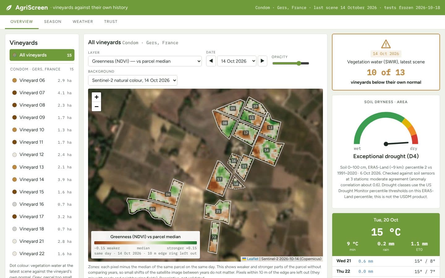
AgriScreen
Vineyards against their own history, from open Copernicus data
active
Nov 2026 Groningen, NL · NRW, DE
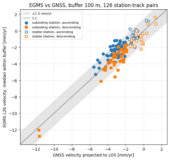
EGMS Check
Does satellite InSAR agree with the ground?